EFTAS Fernerkundung Technologietransfer GmbH
EFTAS.GeoIT
Precisely for your world

Quality &
Individuality
from Münster
since 1988

Geoinformation and IT-services.
Everything fits.

Until the end of the last century, maps were the predominant technology for the acquisition and provision of geographical knowledge.

In our digital age, significantly more than half of all information is spatial – and that proportion is rising. More and more data foster an increasing number of geospatial applications. With a comprehensive knowledge of geoinformation, processes can be optimally controlled through location intelligence to help the right decisions to be made.

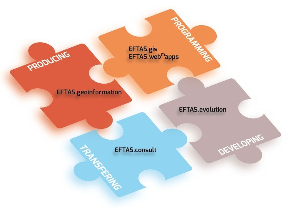
As a leading GeoIT service provider, EFTAS has established an extensive portfolio of one-stop services for different fields of application.

Large quantities of data yes, mass market no. In this way, we can access the individual added value of geoinformation.

GeoIT services

Producing

We produce the geoinformation you need. Detecting, recording, upgrading or processing data – we have expert knowledge in various fields of application.

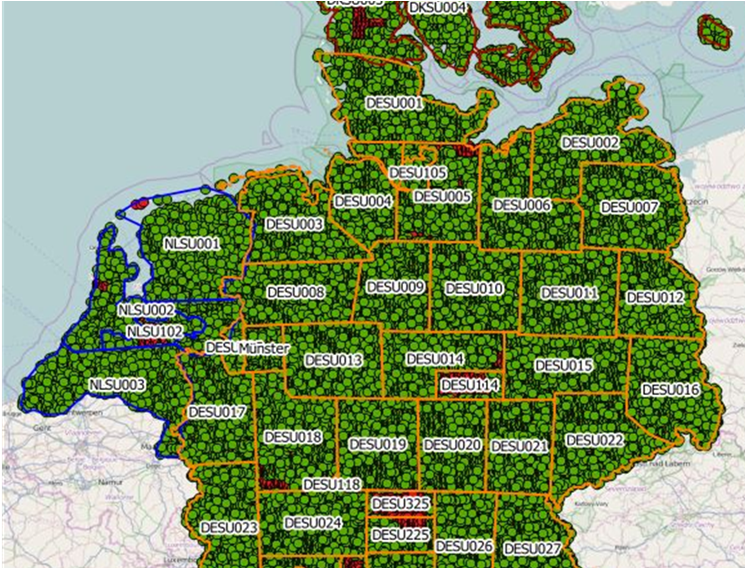
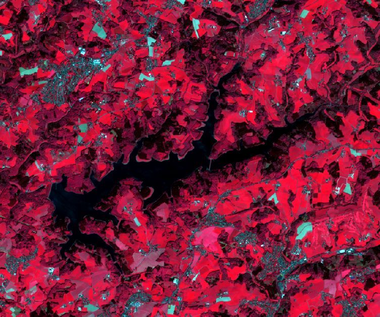
EFTAS.geoinformation
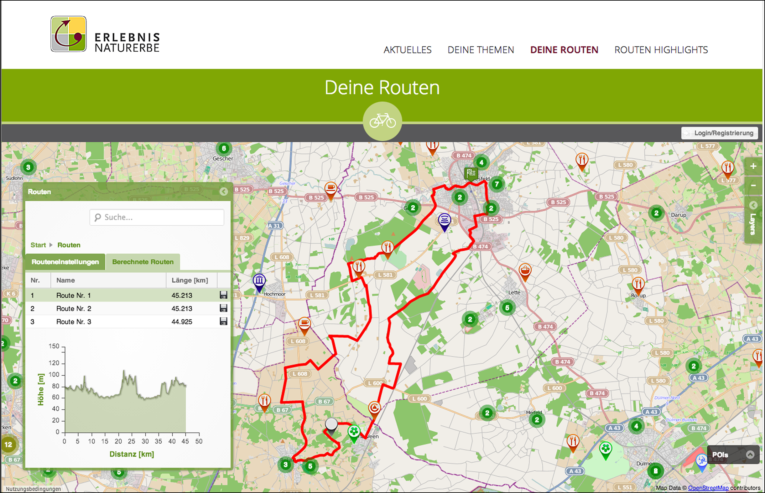
  • We process and analyze aerial and satellite images.
  • We use photogrammetry for 3D mapping.
  • We operate Soil Movement monitoring using radar interferometry (DInSAR) and other complementary data sets.
  • We harmonize multiple data sources e.g. for geostatistical data analysis.
  • We realize AI-assisted and cloud-based Big Data analyses.
  • We map on site.

Remote sensing, photogrammetry, geostatistics and mapping


Sought and found.

The automated update of the ATKIS©-Basis-DLM through remote sensing.

learn more
The automated update of the ATKIS©-Basis-DLM through remote sensing.

Programming

We make geoinformation available to you. With our expert knowledge, we integrate, configure and develop targeted GeoIT solutions for various fields of application. In order to achieve this, EFTAS integrates aerial and satellite imagery, geographic information systems (GIS) and mobile applications.

EFTAS.gis

  • We integrate GeoIT solutions into existing IT systems.
  • We develop specialist modules for standard GIS software.
  • We program interfaces.
  • We integrate GIS into the web.
  • We implement GIS architectures by means of cloud computing technologies.

IT architecture, GIS and interface development


Next Generation.

GIS in times of big data.

learn more
GIS in times of big data.

AgroSurvey.

ArcGIS extension for the control of agricultural subsidies.

learn more
ArcGIS extension for the control of agricultural subsidies.

EFTAS.webmapps

  • We program custom-designed apps with map, GIS and routing functions.
  • We create custom-designed geo portals.
  • We develop methodologies for updating and upgrading content and geoinformation.

Routing, web services, web portal and app programming


Find your own route.

„Erlebnis Naturerbe“: a routing system based on App and web portal.

learn more
„Erlebnis Naturerbe“: a routing system based on App and web portal.

Working in the field.

App for the real-time-management of field surveys.

learn more
App for the real-time-management of field surveys.

Developing

New innovations can be developed with us. New technologies, processes and products – the GeoIT market is highly dynamic. We tap potential for innovation through activities in research and development.

EFTAS.evolution

  • We conduct research and development for practical application.
  • We implement scientific feasibility studies.
  • We operate as a GeoIT partner for cross-iInnovation.
  • We open up new fields of application.

Research, studies, technology and market development


New and globally applicable methods for water conservation.

Keeping an eye on the drinking water quality of reservoirs.

learn more
Keeping an eye on the drinking water quality of reservoirs.

When the rain doesn’t come.

Credit and insurance management in Sudan with GeoIT.

learn more
Credit and insurance management in Sudan with GeoIT.

Transfering

Use our knowledge within your business. Modern GeoIT provides the opportunity to implement location intelligence for changing processes, new business models and a better understanding of interconnections. Together, we can develop the right solution, a tailor-made concept, suitable management, the necessary market survey and custom‑designed integration of GeoIT.

EFTAS.consult

  • We offer targeted advice on adding value with GeoIT.
  • We optimise processes.
  • We carry out studies concerning methods, technologies and data.
  • We offer individual training.
  • We develop solutions for GeoIT implementation on site – worldwide.

Process optimisation, knowledge transfer and training


Monitoring for the protection of biodiversity.

EMBAL - Duet with LUCAS?

learn more
EMBAL - Duet with LUCAS?

LUCAS and Copernicus.

Synergies of European geospatial data sets.

learn more
Synergies of European geospatial data sets.