EFTAS Fernerkundung Technologietransfer GmbH
EFTAS.GeoIT
Precisely for your world

Quality &
Individuality
from Münster
since 1988

GEOINFORMATION AND IT-SERVICES.
Plus [x].

Back in the 16th century, Nicolaus Copernicus turned the world on its head with his revolutionary theory of heliocentrism, which placed the sun – rather than the earth – at the centre of the universe. Fast-forward to the modern day and a European program named after the mathematician and astronomer is now monitoring our planet and achieving unprecedented standards of data quality in geocentric observation. In spite of the shift in thinking that has taken place since his lifetime, Copernicus’ name remains synonymous with the ambitious, large-scale undertaking of observing our planet and using the associated data to understand how our solar system works.

Copernicus is also the name given to the European infrastructure for global satellite-supported monitoring. The program, initially known as “Global Monitoring for Environment and Security” (GMES), has its own infrastructure of space components comprising a fleet of earth observation satellites referred to as the Sentinels. The Sentinel systems record measurements continually, sending a constant stream of new global data back to the scientists on earth. The families of sensors cover a wide range of applications; the program’s own Copernicus service components are generally dedicated to collecting pan-European geoinformation. Data from both sets of components is freely available and can be studied and analysed, in conjunction with other in-situ data sets, by organisations below European Union level.

Designstudy EFTAS 'Europe`s eyes on Earth'

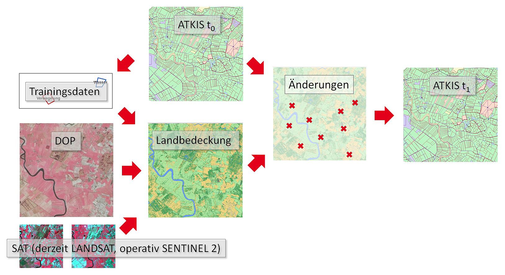
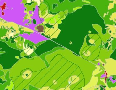
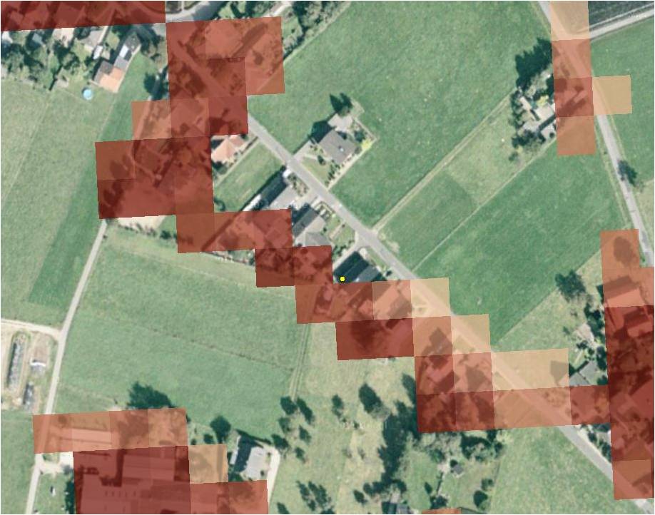
But how do “Europe’s eyes on earth” deliver data that can unlock answers to local and regional questions at scales of 1:10000 or better? The combination with in-situ data is the key that allows Copernicus data to be scaled for a wide range of applications. In-situ data sources include UAV aerial images, official geodata and field maps – providing a variety of data sets that can be thematically and technologically fused with Copernicus data using various geoIT solutions.

We use the technology, data and applications in our day-to-day work, so we view Copernicus as an additional building block in the matrix of geoIT services and applications that we offer to meet our customers’ needs. The scalable components of in-situ data integration are another major plus.

Since the start of the Copernicus initiative, EFTAS technology and networking services have been instrumental in establishing and running the program. We deliver Copernicus plus [x].


Focus Sentinel Data

The Sentinel systems are the primary space components in the Copernicus program. The seven space missions – comprising a combination of the program’s own satellites and sensors on other satellites – enable the program to create radar and spectral images for land observation and for monitoring our oceans and atmosphere.

Sentinel 1 and Sentinel 2 are primarily used for observing land and marine environments. The German Aerospace Centre provides a good overview of the Copernicus space systems at d-copernicus.de/weltraumkomponent.

  • We compile Sentinel archives.
  • We evaluate Sentinel data.
  • We integrate automated interfaces.

DLM Update.

DLM-Update enables users to manage change analysis for cadastral, environmental, agricultural or infrastructural survey via Sentinel-2-data analysis applications in an easy-to-use interface.
more
DLM Update.


Copernicus in EFTAS.content-pool

Focus Information Services

The service components of Copernicus provide pan-European information products spanning a number of fields. The core application domains are land monitoring, marine environment monitoring, emergency management, security, atmospheric monitoring and climate change monitoring.

A full description of the various services can be found at copernicus.eu/main/services. These information products can, in turn, be processed in a wide range of applications.

  • We produce Copernicus information products.
  • We develop downstream services.
  • We integrate Copernicus services.

Copernicus N2K.

The Natura 2000 (N2K) element is part of the Copernicus Land Monitoring Service Components and focuses on these hot spots of biodiversity and human activity.

more
Copernicus N2K.


Copernicus in EFTAS.content-pool

Focus Integration In Situ Data

In the Copernicus program, the in-situ component collates all of the data from observation systems that cannot be operated in space, such as aircraft-mounted remote sensors, sensor networks or field maps.

Information products derived from this data, such as topographical and thematic maps and socio-economic data, are also included. Depending on the data sets, they are used to deliver Copernicus services across Europe or to realise larger-scale applications.

  • We create in-situ data.
  • We unlock in-situ data.
  • We integrate in-situ data.

Copernicus feat. LUCAS.

LUCAS and Copernicus are two completely different programs for the provision of pan-European land use and land cover information. EFTAS analysed the interfaces of these two programs with regard to the aspect of monitoring.

more
Copernicus feat. LUCAS.


Copernicus in EFTAS.content-pool